After brekkie I loaded up the car and did the 20 minute drive to Mt. Roy (Web Page), my hike for the day.
I loaded my backpack with water, snacks and lunch, crossed over the fence and started up. My host had warned me that this was a good pull and that it would be crowded. Also, I had seen the mountain yesterday on my way to Rob Roy glacier and it (Mt. Roy) was completely barren with no trees and no green grass. To be honest I would have preferred another hike but this one was very close and had a good view at the top so I settled on it.
 |
| View from the bottom |
There were quite a few people going up and down but I had my earphones on (I was in "work" mode :-) so I nodded and said "hi" to everyone as they passed but kept going. There were also sheep every now and then to keep weary hikers company; although I'm sure they were thinking, "stupid humans" :-) After the halfway point I begin seeing more and more people crashed out on the side of the trail resting, laying and sleeping. ha ha It was hard not to join them. :-)
As long as I've been hiking I can never recall having ever abandoned a hike short of the summit, but I have to confess that the thought did cross my mind more than once on this climb....more than once. But, I kept pressing on.
Eventually, after about 1:20 of straight climbing I was close enough to the top to actually see the summit.


At this point the trail split with the right side being more gradual and longer and the left being more direct straight up the ridge. Although the more gradual route was appealing my desire to get to the top ASAP won out so up the ridge line I went....


At this point the trail split with the right side being more gradual and longer and the left being more direct straight up the ridge. Although the more gradual route was appealing my desire to get to the top ASAP won out so up the ridge line I went....


After about 10 more minutes of hard climbing I finally reached the summit and, as hoped, the view was stunning.....


After a few pictures I walked around to the other side and saw a couple and the girl had a UNC hat on so of course I had to ask where they were from. :-) Turns out they were not only Carolina fans but they actually live in Chapel Hill (for those who may not know the university of North Carolina is in Chapel Hill). So of course we had plenty to talk about and did for 15 minutes or so. They were a really nice couple....

After eating lunch I took a couple of more pictures and started back down. For those who hike you know that going down is sometimes as difficult (or more) than going up. While not as physically exhausting you really have to watch your step on the very steep stuff or you'll end up going to the bottom like a bowling ball....and that's never a good thing. :-)
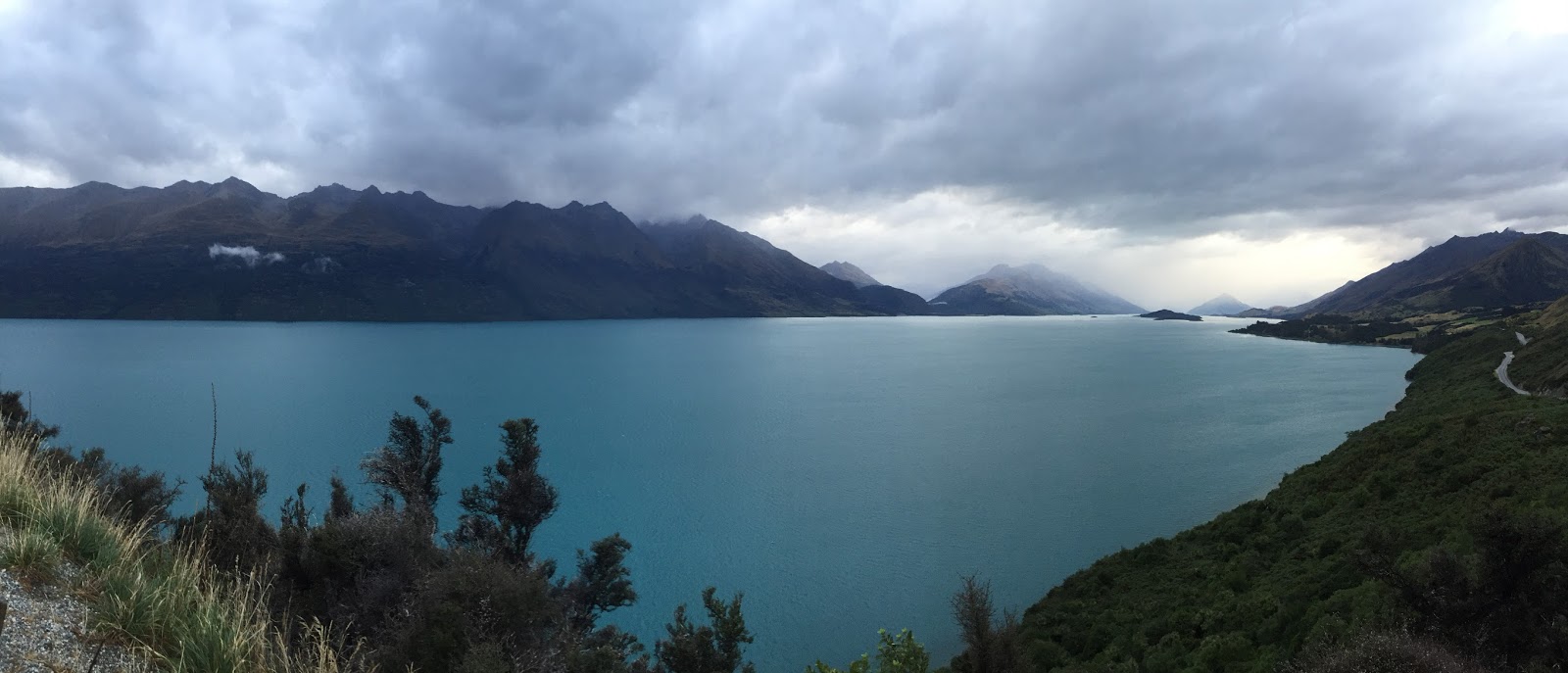
After about an hour I made it back to my car and I set off for Glenorchy (Google, Images), about 2 hours away. I decided to take the Crown Range Highway (Web Page) to get some good views of from this famous mountain pass. There was also a mountain along the way from which you could see some of the landscape where they filmed The Lord of the Rings. But unfortunately about 20 miles outside of Wanaka it began raining hard with really low clouds so I knew driving to a mountain top in this would be a waste of time. So I drove through to Queenstown (Google, Images).
It was still raining when I arrived in Queenstown and about 5:30 so traffic was really bad. Queenstown is a nice, larger (by NZ standards) town with just about everything you need. It is also a huge "outdoor" town and hosts many, many, many tourist, backpackers and hikers. Queenstown was basically built in a gorge that opens into the ginormous Lake Wakatipu (Google). Unfortunately there is no other way to get to Glenorchy than to go straight through Queenstown so I sat in traffic. Anticipating that there would potentially be no restaurants and knowing there would be no groceries in Glenorchy (I was booked at a hostel) I stopped in Queenstown to get some food for breakfast. And as much as I hate to admit it, I also stopped for dinner at Burger King (they are called Burger King in NZ unlike AU) because they had free wi-fi and I didn't think I would have any wi-fi or cell coverage in Glenorchy.
So about 7:30 I started the 45 minute trip to Glenorchy. The drive was nice and very curvy going around the lake (it reminded me of the Great Ocean Road in AU). It had stopped raining but the clouds were still low on the mountains in the distance. Considering this is the area where quite a bit of the Lord of the Rings was filmed it seemed kind of fitting that the mountains would be shrouded in clouds....

I finally reached Glenorchy just before dark. I drove around thinking my lodge would be easy to find, since there are only 2 streets and about 8 buildings in Glenorchy, but for some reason I just couldn't find it. So after a few minutes I checked my phone (thankfully I had signal) and I discovered that my lodge was not actually in Glenorchy but was in Kinloch 25km (15.5 miles) further....UGH!!!! By this time it was dark, I was very tired and it was raining again. I was not a happy camper but the only person I could be mad at was myself. So, I turned left (on the only highway in Glenorchy) and headed to Kinloch.
Kinloch (Google) basically consists of the Kinloch lodge (where I stayed) and that's it! It's both a regular B&B and a backpackers hostel and it seemed to have a nice restaurant. Anyway, I checked in, found my bed and my suite mates and went to the dining area with my laptop (fortunately they had wi-fi) to work on the blog and try and figure out what I am doing tomorrow in the land of Middle Earth. :-)
 |
| Where Am I |
No comments:
Post a Comment